Walks
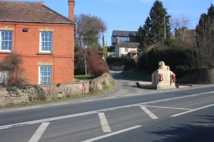
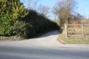
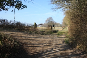
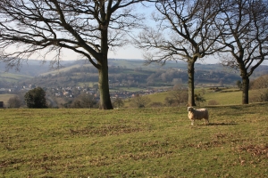
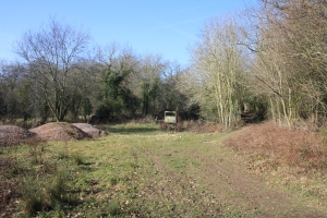
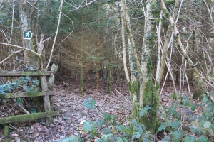
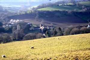
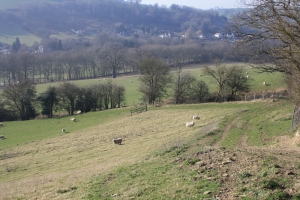
From the Post Office walk south along Church Road until you come to the junction with the Latchen and turn left. Keep walking up the incline until you meet the main A4136 Monmouth Road and turn left again, and walk past Knapp House (a very old house from the 1400s) and go as far as the War Memorial (photo 1) and turn left again (Old Hill), up a seriously steep incline! Keep walking and stop to catch your breath at the top by the gate to a field just before the newer houses on the left, and enjoy the view. Continue on the level until you once more meet the main A4136 Monmouth Road with the Baptist Church opposite. Turn left once more and travel a few yards along the road and take the first turning you come to on the left up a narrow road (photo 2). (There is a public footpath sign marking it, but it is obscured by the hedge.) Go past the barn conversion on your right, and you will see a fork in the track. Take the right which is really straight on, either over or round the large gate with a postbox on it (photo 3), and continue along this track, admiring the views over Longhope valley on your left as you go (photo 4).
 |
 |
 |
| Photo One | Photo Two | Photo Three |
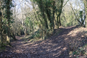
You will then come to a clearing with some rusting redundant farm vehicles and a track through woodland to the right (photo 5). Follow this path for quite a way, ignoring the marker post with other footpath options, and shortly after this the path forks (photo 6). It doesn�t really matter which one you follow, but we suggest you take the right turn up the slope, as it is an easier path overall.
 |
 |
 |
| Photo Four | Photo Five | Photo Six |
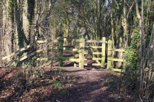
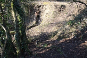
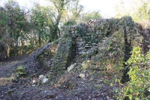
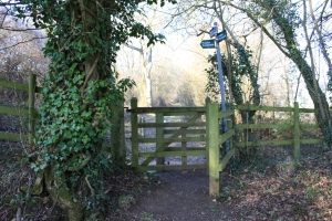
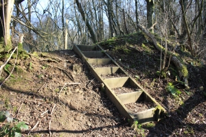
Continue on either path until you come to a wooden kissing gate (photo 7). You are now entering the SSSI (Site of Special Scientific Interest), so we must advise you to treat it with respect please. This area also belongs to Gloucestershire Wildlife Trust, so keep your eyes open for unusual or rare flora and fauna, but please don�t remove anything � just enjoy it in its� habitat. Further along the path you will come across three steps down (photo 8), and then take the path to the right, but stop to survey the old lime kiln buried in the mound here (photo 9).
 |
 |
 |
| Photo Seven | Photo Eight | Photo Nine |
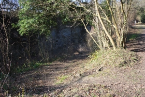
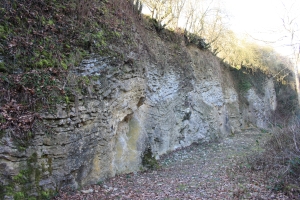
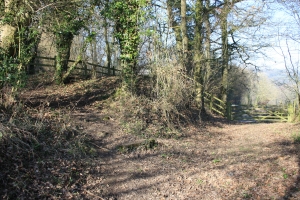
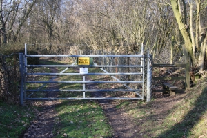
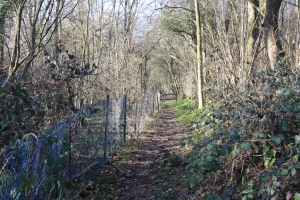
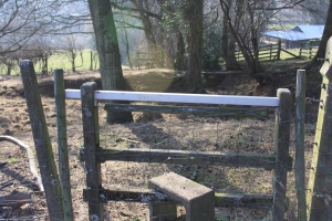
Follow the path along once more and just before the display board you will see a track down into Hobbs Quarry on your left (photo 10). You may choose to enter the quarry and get closer to these ancient rocks, but take care and please don�t remove any rocks from the rock face (photo 11). If not, continue along the main path through the woodland until you come across a stile on your right. Ignore this, but a few yards beyond this is a small path to the left (photo 12) that leads up to a wooden kissing gate (photo 13) and a narrow road.
 |
 |
 |
| Photo Ten | Photo Eleven | Photo Twelve |
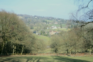
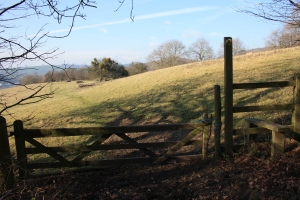
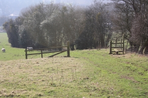
Cross this and then over the stile beside the farm gate on the opposite side, and continue along the track, admiring the view of the foothills of May Hill (photo 14) and the hill itself if the trees are bare. You will come across another farm gate with another stile to the right (photo 15).
 |
 |
 |
| Photo Thirteen | Photo Fourteen | Photo Fifteen |
Continue following a narrow path for quite a way, always keeping the barbed wire fence on your left, and also more of the quarry (photo 16). You will come across a set of wooden steps down (photo 17), as you proceed through Sculchurch Woods, which is made up of ancient indigenous trees. Again, continue to follow the wire fence along, beside an enclosed piece of land containing stacks of logs, and also note that it takes a sharp left bend. You will next come across a small wooded area of Christmas trees and a sign on one of them to take a right turn (photo 18). Take this short path until you see a signpost for a left turn along a track, through the woods still.
 |
 |
 |
| Photo Sixteen | Photo Seventeen | Photo Eighteen |
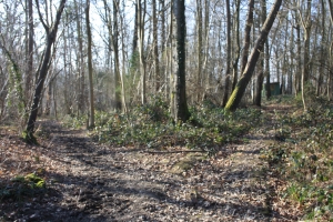
You will meet a fork in the tracks shortly and may spy a green wooden shed along the path to the right, but you must take the left path (photo 19). Continue through the woods along what is usually quite a muddy path, until you come to a field (photo 20), a stile and a farm gate (unusual in that it has been sawn off and is easier to climb over than the stile to the right!!) The public right of way turns to the left and down the hill and across, but we were naughty and nipped across the field in a straight line. Admire the view down to the church from here (photo 21).
 |
 |
 |
| Photo Nineteen | Photo Twenty | Photo Twenty One |
Pass a disused wooded quarry on the right, and go down a farm track (photo 22), to the far corner of this field. When you get there, you will see on your right another footpath that takes you into this wooded quarry. You can go and have a quick peep if you wish, but our walk picks up a public footpath again (so we are legal) and takes a left turn down the hillside, ignoring the stile all alone (photo 23), keeping the hedgerow on your right, until you reach another stile at the bottom corner (photo 24).
 |
 |
 |
| Photo Twenty Two | Photo Twenty Three | Photo Twenty Four |
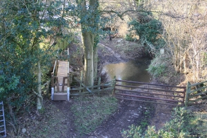
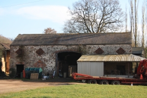
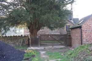
Cross the old railway trackbed to another stile. Again, down the field, keeping the deep ditch to your right, to the bottom corner where you meet a track into the field. To the left of the farm gate you will see a picturesque wooden footbridge with stiles either end, over a brook (photo 25). Follow a track beside a house that takes you into the farmyard (dogs do run free here sometimes). Cross the farmyard, noting the ancient barn on your left (photo 26), and head for the yew tree, the church and a kissing gate (photo 27). Go through the churchyard to the main gate and out on to Church Road (stop for a while to view the church which is generally kept open during the day from 10-4pm). Take a left turn and follow Church Road along for quite a distance into the village and back to the Post Office.
 |
 |
 |
| Photo Twenty five | Photo Twenty Six | Photo Twenty Seven |