Walks
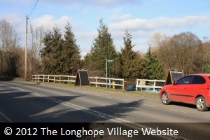
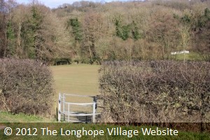
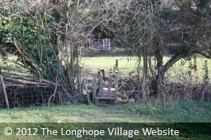
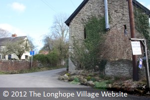
From the Post Office, head in a northerly direction along Church Road, until you meet the A40 Ross Road. Turn left (which is essentially straight on) and walk a few yards until you come to The Nags Head pub on the left. Cross over the road and you should see the Public Footpath sign (photo 1). Go down these steps and cross the car park to the kissing gate (photo 2). Go through the gate and cross the small field to the far left corner where you will see a small bridge crossing a brook (photo 3) into another small field with another kissing gate.
 |
 |
 |
| Photo One | Photo Two | Photo Three |
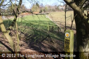
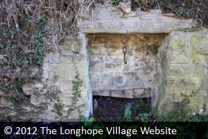
Go up the steep old railway embankment, and down the other side (photo 4). Go through the small wooden gate, and, keeping the electric fence on your right, make your way to the kissing gate at the other side, which leads onto a road. Turn right on the road (this is Barrel Lane) and continue a few yards. Just past The Old Farm, there is a narrow dead-end lane (photo 5). Take this lane up the hill, noting in the wall on the right before the houses, the site of an old well, (photo 6) identified by a hook hanging on a chain. This hook was used to keep open the lid of a well. (Unfortunately, when Severn Trent laid a new water pipeline, they disturbed the water-course, and the well ran dry.)
 |
 |
 |
| Photo Four | Photo Five | Photo Six |
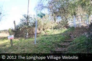
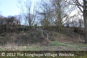
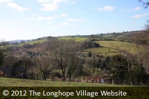
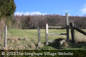
Continue up the lane, and just past a very old cottage (Mutlow Cottage), you will see some steep steps on the right leading to another kissing gate (photo 7) and a steep muddy track beyond. At the top of this track is a stile, and continue diagonally right across the field to another stile up some steps (photo 8) and stop to admire the view behind you as you do (photo 9).
 |
 |
 |
| Photo Seven | Photo Eight | Photo Nine |
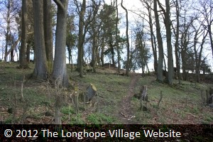
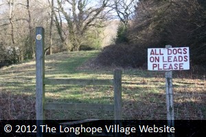
Take another diagonal right to a very small copse area and follow the track up through this (photo 10). (There is a small wooden seat to sit on, if you need a rest, but you will have to look for it!) Ahead of you, you will see fields (photo 11). Keep the hedgerow on your right and walk in a straight line to the first stile, cross this, and again continue in a straight line to another stile (where there is a sign warning you to keep dogs on a lead) (photo 12).
 |
 |
 |
| Photo Ten | Photo Eleven | Photo Twelve |
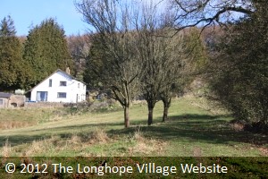
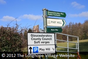
Again, follow the track straight ahead and keep to the right of the white farmhouse (Mayhill Farm) (photo 13) where you should spot another stile marked footpath (photo 14). Follow the track straight ahead to another stile, which leads you onto another road. Turn left and walk a few yards in front of an unusual looking house (High Meadows) and you will see several footpath signs indicating May Hill to the right (photo 15).
 |
 |
 |
| Photo Thirteen | Photo Fourteen | Photo Fifteen |
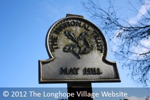
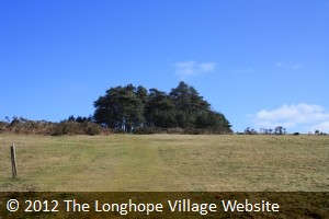
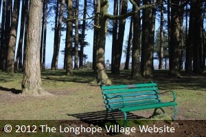
Follow this steep track straight ahead through some conifer woods and up several steps to another gate. Here you will see a sign for May Hill (photo 16). Keep walking in a straight line to the summit with the small conifer wood, and you have arrived on the top of May Hill (photo 17). Take a seat and enjoy the view! (photo 18) To return, retrace your steps - the going back is a lot easier than the going up!
 |
 |
 |
| Photo Sixteen | Photo Seventeen | Photo Eighteen |